
Popham Beach: The Wildest Beach in Maine
Massive sandbars, spinning currents, and Civil War forts. A guide to Popham Beach State Park.
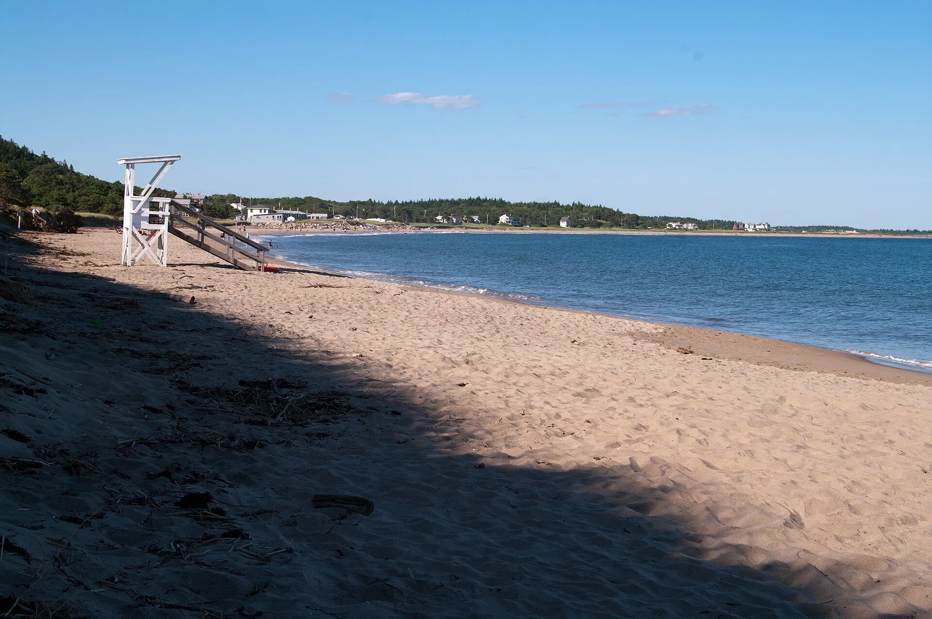
Popham Beach State Park in Phippsburg is unlike any other beach in Maine. Located at the mouth of the mighty Kennebec River, where freshwater meets the Atlantic, it’s a place of shifting sands, powerful currents, and dramatic natural forces. The beach changes with every tide. Sandbars appear and vanish, islands become walkable peninsulas, and the collision of river and ocean creates swirling currents that demand respect.
This is a beach for adventurers, beachcombers, and anyone who appreciates wild places. The wide-open expanses of sand at low tide feel almost otherworldly. Note that the walk to Fox Island across the tombolo, long the signature of this beach, no longer works as it used to: see the section below before planning around it. But Popham also requires attention. The same dynamic forces that make it spectacular can be dangerous for the unprepared.
The Landscape
A Beach That Never Stops Moving
The Kennebec River carries massive amounts of sediment to the ocean, and Popham Beach is where that sand accumulates. The result is a constantly shifting landscape:
At high tide: A relatively narrow beach backed by dunes. The water comes close to the dune line, and Fox Island sits offshore, separated by open water.
At low tide: The beach transforms. Hundreds of yards of flat, hard-packed sand emerge. Sandbars stretch toward the horizon. And most dramatically, a sand bridge appears connecting the mainland to Fox Island.
The scale: At extreme low tides, the beach can extend over a mile from the dune line. The flat, firm sand is perfect for walking, running, or just standing in awe of the space.
Fox Island and the Tombolo
Fox Island sits just offshore, a small rocky island topped with beach roses and sea grass. It was long reached by a tombolo, a natural sand causeway exposed at low tide. The beach here moves, though, and the causeway is no longer the straightforward connection to the mainland it once was.
The walk no longer works as described, and this page used to describe it. The Bureau of Parks and Lands states that visitors can “no longer walk to Fox Island at low tide without crossing the mouth of the Morse River”. The river has migrated across the beach and the tombolo is no longer a simple sand causeway from the mainland. BPL also warns that two hours after low tide the sandbars are under cold, fast-moving water.
That is a different and more serious proposition than the firm, flat 10-to-15-minute stroll this page previously promised. Fording a river mouth on a falling window, with a current running, is how people get into trouble here.
Treat Fox Island as a look, not a walk. Admire it from the beach. If you are set on crossing, speak to the rangers on the day and take their answer as the last word, not the tide chart.
The Tide Warning
This is critical: The tombolo floods quickly when the tide turns. What was walkable sand becomes waist-deep water within an hour, then shoulder-deep, then impassable.
People get stranded on Fox Island because they misjudge the tide, and the Morse River crossing has made that easier to do, not harder.
How to stay safe:
- Check the tide chart before you go, posted at the park entrance, and understand it is no longer the only variable: the Morse River mouth is
- Ask the rangers about current conditions on the day. Conditions here change year to year as the river migrates
- BPL’s own guidance is that two hours after low tide the sandbars are under cold, fast-moving water, so the usable window is short and it closes faster than people expect
- Note the 2026 lifeguard season at Popham ended on 30 August, so for much of the shoulder season there is nobody watching the water
An earlier version of this page told readers to “only cross to Fox Island on an outgoing tide” and to “leave at least 2 hours before high tide”, advice that assumed a crossing which the land manager says is no longer available.
Swimming and Water Safety
Popham’s beauty comes from the same forces that make it dangerous. The collision of the Kennebec River’s outflow with incoming ocean tides creates complex, powerful currents.
The Currents
The spin: Where river meets ocean, water swirls in unpredictable patterns. You might be standing in knee-deep water and feel a strong pull in one direction, then a different direction moments later.
Undertow and rip currents: Present, especially near the channels between sandbars and around the Fox Island tombolo.
The river channel: The deep channel where the Kennebec exits is particularly dangerous, fast-moving water with strong currents. This is not a swimming area.
Safe Swimming
Lifeguards: On duty during summer season (typically late June through Labor Day). Swim within the designated areas marked by flags.
Best areas: The guarded section of beach near the main parking area offers the safest swimming. Water here is still dynamic but monitored.
Water temperature: Cold. Typically 55-65°F even in summer. The river water mixing in can make it feel even cooler.
Who should be cautious: Inexperienced swimmers, children, and anyone uncomfortable with unpredictable currents should stay in shallow water within the guarded area.
Surfing
Popham is a legitimate surf spot, particularly in fall and winter when swells are larger.
What to expect: Beach breaks over sandbars. Quality varies with conditions, but good days offer fun, accessible waves.
Best season: Fall through spring. Summer tends to be smaller and more crowded.
Hazards: Cold water (wetsuit essential except in warmest summer), currents, and shifting sandbars that change the break.
Fort Popham
Just a few minutes’ drive from the beach (or a walk along the shoreline road) sits Fort Popham, a striking semicircular granite fort built during the Civil War.
History
Construction began in 1861 to protect the Kennebec River and the shipyards at Bath from Confederate naval attack. The fort was never completed, the Civil War ended before construction finished, and it never saw combat. What remains is a massive granite shell, its arched casemates and spiral staircases open for exploration.
Visiting the Fort
Admission: Free (as of 2026), though there may be a small parking fee.
What to see:
- Walk through the dark, echoing archways of the casemates
- Climb spiral staircases to upper levels for views of the river mouth
- Explore the massive granite construction. The stonework is impressive
- Read interpretive signs about the fort’s history and construction
Condition: Some areas may be closed for restoration. Check current access before planning your visit.
Fishing at Fort Popham
The rocky point at Fort Popham is legendary among Maine anglers, particularly for striped bass.
What people catch: Stripers (striped bass), bluefish, mackerel, occasional flounder.
Best times: Dawn and dusk, particularly on incoming tides.
Access: Fish from the rocks or the small pier area. Be careful on wet rocks. They’re slippery.
Beachcombing
Popham is one of the best beachcombing beaches in Maine, thanks to the constant sand movement that deposits treasures along the tide line.
Sand Dollars
Popham is famous for sand dollars. The extensive sandbars at low tide are prime hunting ground.
Where to look: Along the tide line, in shallow tide pools, and on the exposed sandbars toward Fox Island.
When: Low tide, especially after storms that churn up the bottom.
Tip: Look for the intact, white-bleached shells. Living sand dollars (fuzzy, dark-colored) should be left in the water.
Other Finds
- Sea glass (less common but present)
- Shells (clams, mussels, moon snails)
- Driftwood
- Interesting rocks and stones smoothed by the waves
- Occasional sea urchin shells
Practical Information
Getting There
Popham Beach is at the end of Route 209 in Phippsburg, about 15 miles south of Bath.
From Portland: About 50 miles, roughly 1 hour via I-295 and Route 1 to Bath, then Route 209 south.
From Brunswick/Bath: About 20 minutes via Route 209.
The drive: Route 209 winds through the scenic Phippsburg peninsula, passing historic homes, small cemeteries, and glimpses of the ocean.
Parking and Admission
State park entrance fee: Charged per person, not per vehicle. $6 for Maine resident adults, $8 for non-resident adults, $1 for children 5 to 11, free for children under 5 and for Maine residents aged 65 and over. Bring cash: only about 15 state park locations take cards, and only when the entry booth is staffed.
Parking lot: Large, but it fills on sunny summer weekends, and when it is full the park closes to new arrivals rather than queuing you. That is the part worth planning around: a full lot means being turned away, not waiting.
Strategy: Come early on summer weekends, or pick a weekday, the shoulder season, or an overcast day.
Overflow: When the main lot fills, there’s limited roadside parking, but it’s often far from the beach.
Facilities
- Restrooms (flush toilets, changing areas)
- Outdoor showers for rinsing off
- No food concessions in the park. Bring everything you need
- Picnic tables in the dunes area
What to Bring
- Sunscreen (little shade on the beach)
- Water and snacks/lunch
- Layers (wind can be cool even on warm days)
- Tide chart or check times before arriving
- Binoculars (for bird watching and scanning the water)
- Sturdy shoes if planning to explore Fort Popham’s rocky areas
Best Times to Visit
For the Fox Island walk: Time your visit around low tide. Check tide tables and arrive 1-2 hours before low tide for maximum exploration time.
For swimming: High tide brings deeper water closer to shore, which some prefer. But currents can be stronger.
For beachcombing: Low tide exposes the maximum beach area and tide line treasures.
For avoiding crowds: Early morning, late afternoon, weekdays, or September.
Nearby Attractions
Hermit Island
A private campground/beach on a small peninsula nearby. Day visitors can pay to access the beaches when not fully booked with campers. Worth checking if Popham is full.
Seguin Island Lighthouse
Visible from Popham Beach, Seguin Island sits offshore at the mouth of the Kennebec. Boat tours run from the area in summer, offering visits to this historic lighthouse.
Morse Mountain and Seawall Beach
A few miles north, the Bates-Morse Mountain Conservation Area offers a 2-mile walk through protected land to pristine Seawall Beach, one of the most beautiful and least developed beaches in Maine.
Bath
The “City of Ships” is about 15 miles north. Visit the Maine Maritime Museum for the region’s shipbuilding history, or explore the downtown with its shops and restaurants.
Seasonal Considerations
Summer (June-August): Peak season. Warmest water, lifeguards on duty, largest crowds. Arrive early for parking.
Fall (September-October): Excellent time to visit. Fewer crowds, still pleasant weather, better surf. No lifeguards.
Winter: Dramatic and uncrowded. Cold but beautiful. Surfers in wetsuits, photographers, and hardy walkers. Dress warmly.
Spring (April-May): Beach emerges from winter. Can be cold and windy but uncrowded. Good for beachcombing after winter storms.
Popham Beach rewards those who pay attention, to the tides, to the currents, to the constantly shifting sand. It’s a place where nature is clearly in charge, and the experience changes with every visit. Walk to Fox Island, explore Fort Popham, hunt for sand dollars, or just stand on the vast expanse of sand and watch the river meet the sea. There’s nothing else quite like it in Maine.