
Moosehead Lake: The Inland Sea
Maine's largest lake, verified at source. Katahdin cruise fares, the Mount Kineo shuttle, Lily Bay fees, floatplane prices, and which roads north of Greenville are private.
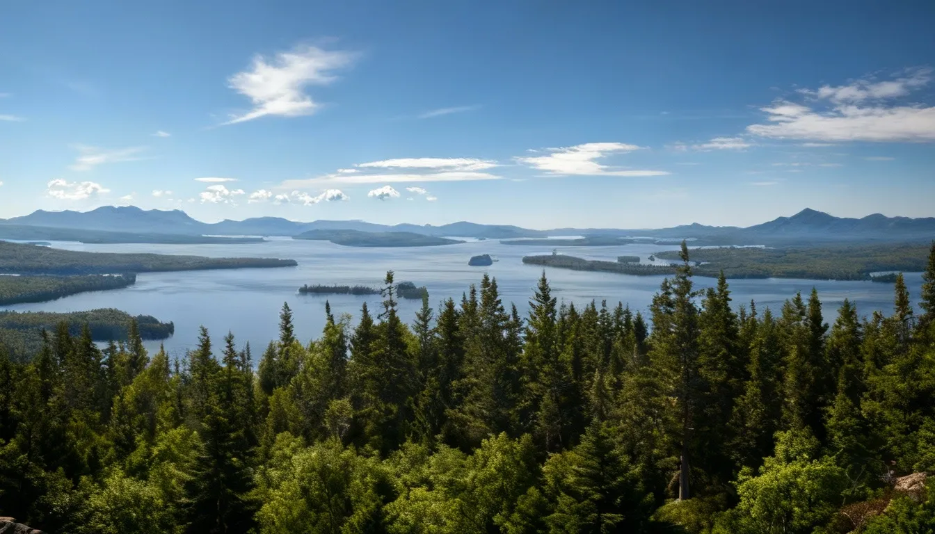
Moosehead Lake is the largest lake in Maine and, by the Bureau of Parks and Lands reckoning, “New England’s largest freshwater body.” The Maine Geological Survey puts it at 117 square miles against Sebago’s 45. The state’s management plan for the lake describes it as “nearly 30 miles in length, with over 245 miles of diverse shoreline,” and the fisheries survey chart records 74,890 acres. Surrounded by dense forest and rimmed by mountains, it feels more like an inland freshwater sea than a typical New England lake.
This is the heart of the Maine Highlands. Moosehead is the headwaters of the Kennebec River and sits at the gateway to the North Maine Woods, and the wilderness still dominates.
The lake has drawn visitors since the mid-1800s, when wealthy “sports” and “rusticators” traveled by train and steamboat to grand hotels and sporting camps. That era has faded, but the character remains. Greenville, at the lake’s southern tip, is the gateway to vast stretches of undeveloped Maine, including the western approach to Baxter State Park and Katahdin.
Getting There
From Portland: roughly 150 miles and about three hours, via I-95 to Newport, then Routes 7, 23 and 15 through Guilford to Greenville.
From Bangor: roughly 70 miles and about 90 minutes, via Routes 15 and 6.
From Bar Harbor: roughly 130 miles and about three hours.
These are approximations. No agency or operator publishes drive times for this route, and the last stretch is slow, winding, and genuinely thick with moose crossing signs.
Once you arrive, the Bureau of Parks and Lands gives the local distances: Rockwood is 15 miles northwest of Greenville on Routes 15/6, also called the Rockwood Road. Lily Bay State Park is about nine miles north on the Lily Bay Road, and Kokadjo is another ten miles beyond that.
The Roads North Are Private
This is the single most important thing to understand before you drive out of Greenville, and most guides do not say it.
The Bureau of Parks and Lands is explicit: “Only two state transportation roads provide access to the lake: Route 6/15 from Greenville to Rockwood on the west shore of the lower basin and a road from Greenville to Lily Bay on the east shore of the lower basin. All other road access to the lake is over private roads originally constructed for timber management.”
Those private roads are working industrial roads. You are a guest on them.
Gates and fees. Head north past Rockwood and you reach the Twenty Mile Checkpoint, run by North Maine Woods, Inc., which manages public access to millions of acres of private forest. The organisation locates it “approximately 20 miles from Rockwood,” beyond the bridge over the South Branch of the Penobscot River, open 6am to 9pm daily, with after-hours self-registration on the checkpoint porch or through the Seboomook Electronic Gate. Fees are per person, not per vehicle: $13.00 per person per day for Maine residents, $18.00 for non-residents, with camping adding $12 and $15 per night on top. Under 18 is free for day use and camping. Age 70 and over is free for day use. Every visitor has to log in and log out at a checkpoint on each visit.
Trucks win, always. North Maine Woods puts it in capitals in its own regulations: “TRUCKS HAVE THE RIGHT OF WAY.” The Bureau of Parks and Lands spells out the practice: pull over and stop for trucks regardless of which direction they are heading, avoid roads too narrow for two vehicles, do not block side roads, and never stop where visibility is poor.
Carry a spare. The Bureau’s own warning: “Roads can be dusty in dry weather and washed out in wet weather. Gravel roads are hard on tires (and suspension systems): travel slowly and carry a spare tire.” Its shoreline guide adds a note worth taking literally: “carry a recent gazetteer. Road systems associated with timber management change frequently.”
For the road west from Millinocket, see our Golden Road guide, which covers that private road’s checkpoints and rules in detail.
Greenville: Gateway to the Highlands
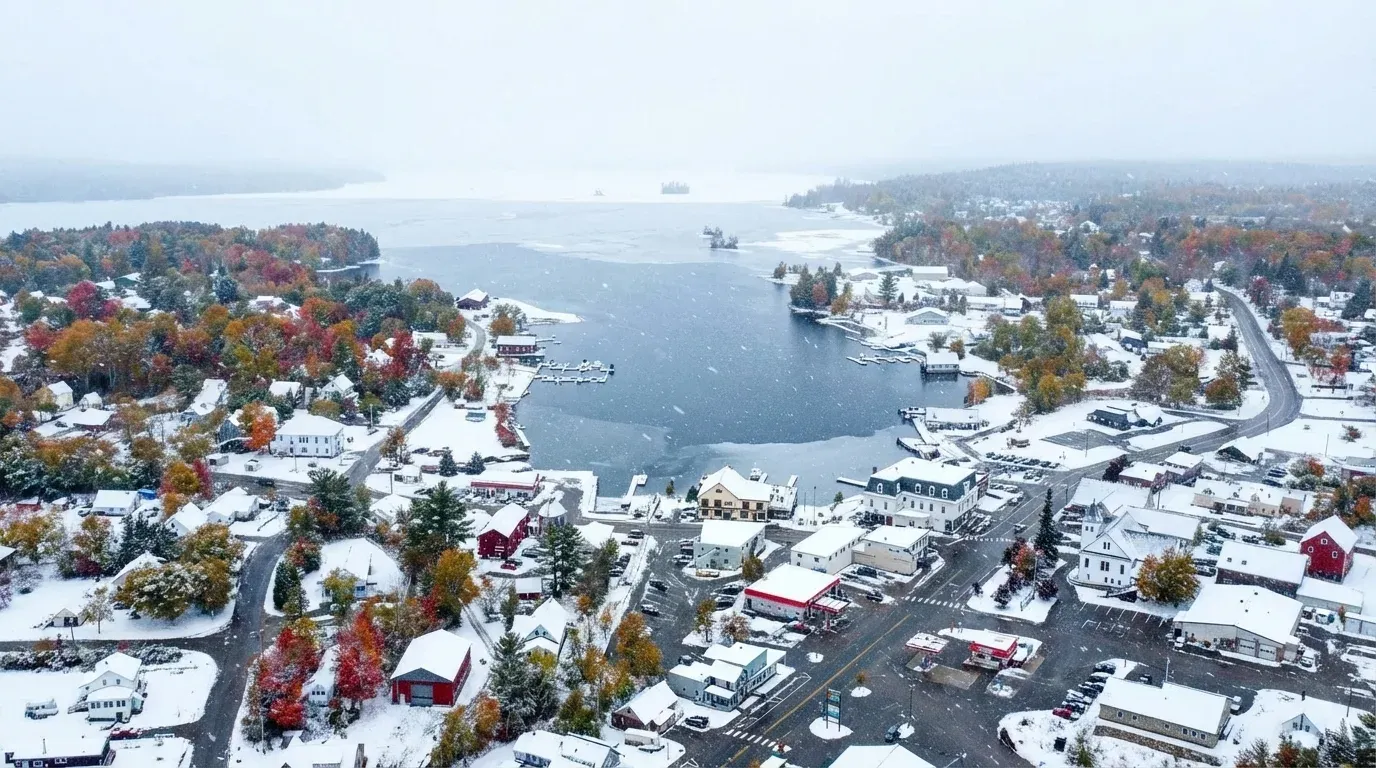
Greenville is the only real town on Moosehead Lake. The US Census Bureau estimated its 2024 population at 1,677, up from 1,439 in the 2020 count. Everything else around the lake is camps, cabins and forest. The town calls itself “your basecamp for exploring the greater Moosehead Lake Region and Maine’s 100-Mile Wilderness,” which is about right.
What you’ll find:
- Outfitters and Registered Maine Guides
- Two floatplane operators flying off the lake
- The Moosehead Marine Museum and the steamboat Katahdin
- Lodging from campsites to a Relais and Châteaux inn
- Groceries and outdoor gear at Indian Hill Trading Post, 148 Moosehead Lake Road
What you won’t find:
- Chain hotels or restaurants
- Big-box stores
- Reliable cell service more than a few miles out of town
The big event: the International Seaplane Fly-In runs 10 to 13 September 2026, its 52nd year. Book lodging early or plan around it.
The Steamboat Katahdin (“The Kate”)
The best way to grasp Moosehead’s scale is from the water, aboard the Katahdin.
The History
The Katahdin was built in 1914 by Bath Iron Works and later converted to diesel. She is a National Historic Site, and she is the last of a fleet: steamboat traffic began on Moosehead in 1836, and the operator records that as many as 50 boats once worked the lake carrying passengers, livestock, mail, supplies and equipment. By the late 1930s, with roads reaching around the lake, only the Katahdin was left.
She worked as a towboat hauling booms of logs until 1975, and took part in the nation’s last log drive. When plans surfaced to scuttle her, local citizens founded the nonprofit Moosehead Marine Museum in 1977 and acquired her as its star exhibit. She joined the National Register of Historic Places in 1979. The original plan was a static floating museum, but a marine survey found she could be made seaworthy again, so she sails.
The Cruises
There is no single “Moosehead Lake cruise.” Katahdin Cruises runs a slate of them at different lengths and prices. The two that most visitors choose:
Sugar Island Cruise, the most popular, 3 hours, boarding 12:00pm and departing 12:30pm. $50 adult (18-64), $45 senior (65+), $30 youth (11-17), $25 child (3-10), free under 3.
Mt. Kineo Cruise, 5 hours, boarding 10:30am and departing 11:00am, running past Lily Bay and Sugar Island to Mount Kineo. $60 adult, $55 senior, $35 youth, $30 child, free under 3. Note that the operator describes this as a cruise to Kineo, not a landing. If you want to hike Kineo, take the Rockwood shuttle instead.
Others on the schedule include a 2-hour Moose Island Cruise from $40 and an 8-hour Head of the Lake Cruise from $125 with breakfast and dinner included, plus evening music and themed cruises for ages 21 and over.
What you’ll see: Mount Kineo rising from the water, loons, eagles and ospreys, occasionally moose on shore, and former mill and camp sites along the way. Narration is included on every cruise.
Practicalities. Museum admission is included in every cruise ticket. Maximum capacity is 225. There is a working galley selling sandwiches, snacks, soft drinks, beer and wine, and outside food and alcohol are not allowed aboard. No pets except certified service animals. Children 12 and under must wear a life jacket, supplied free. The first deck is accessible. The operator’s FAQ says the Katahdin cruises rain or shine, tickets are nonrefundable unless the operator cancels, and there is a 10% military discount for tickets bought in person.
Do you need to book? Contrary to what most write-ups say, the operator states that reservations are required only for special events and special cruises. Booking is still sensible in peak season, and tickets can be bought online, at the museum gift shop, or by phone on 207-695-2716.
Moosehead Marine Museum
The museum at 12 Lily Bay Road on the Greenville waterfront is the ticket office as well as the exhibit hall, and it is open seven days a week from late June through mid-October. Admission is included with a cruise ticket; if you only want the museum, admission is by donation.
Mount Kineo
Mount Kineo dominates the middle of the lake. The Bureau of Parks and Lands gives the summit at 1,789 feet, with a cliff face rising 700 feet above the lake surface. Those cliffs are critical habitat for rare plants and for peregrine falcons, an active breeding site since 1987.
The Geology and History
Kineo is volcanic rock, felsite and rhyolite, that fractures with sharp edges. For thousands of years people came here to quarry it. The state’s shoreline guide records that Wabanaki people including the Penobscot, who have lived around Moosehead for the past thousand years, “relied on flint-like felsite and rhyolite from Mt. Kineo to make stone tools (such as arrowheads and chisels) that were used and traded throughout New England.” The name itself is said to come from Kinneho, a Wabanaki warrior of legendary power.
The Mount Kineo House was not one hotel but three. A tavern went up in 1844, expanded in 1848, and burned to the ground in 1868. Its more luxurious replacement burned in 1882. The third and grandest opened in 1884 with 200 rooms, a bowling alley, a music room, a library and a golf course, and by its 67th season in 1911 it could accommodate 500 guests in a dining room seating 400. The state’s history calls it, at its peak, “the largest inland water hotel in America.” The Maine Central Railroad dropped its Kineo branch in 1933 and the hotel was sold and taken down in 1938. The golf course is still there. The hotel is not.
Getting There
There is no road to Kineo. The Bureau is unambiguous: public lands on Mount Kineo, Farm Island and Sugar Island “are accessible by water only.” Your options:
The Kineo Shuttle. A small commercial boat runs from the Rockwood Public Landing. Per the schedule published by Destination Moosehead Lake, the regional chamber of commerce, the 2026 season runs 22 May to 13 October, and the crossing takes about 10 minutes.
- May and June: departs Rockwood 9:00am, 11:00am, 1:00pm, 3:00pm; last return from Kineo 4:45pm.
- July and August: departs Rockwood on the hour, 8:00am to 6:00pm; last return 6:45pm.
- September and October: departs Rockwood on the hour, 9:00am to 4:00pm; last return 4:45pm.
Round trip is $15 per person for ages 5 and older, cash only. Under 5 free, dogs free, bicycles $5. In good weather the boat carries 10 to 28 passengers and the captain may take fewer in rough water; if more people are waiting than can safely cross, the shuttle returns for them.
Budget for the park fee too. Mount Kineo is a state park, and the Bureau charges day use “payable at self-service station at the property entrance.” The published rate is $3.00 adult Maine resident, $4.00 adult non-resident, $1.00 non-resident senior, per person. That is on top of the shuttle.
Kayak or canoe. The crossing from Rockwood is 0.8 miles, not the half mile often quoted, and it is open to wind and boat traffic. See the safety note below before you attempt it.
Your own boat. Dock at the peninsula and walk in from there.
The Hikes
From the boat landing, turn left and follow the shoreline path past private property onto state land. The Bureau puts a full circuit of the peninsula at 4.2 to 5 miles, about 3 hours in good conditions.
Indian Trail: 0.9 miles to the summit from the Carriage Trail, climbing steeply along open ledge. Spectacular, exposed, and unpleasant if you dislike heights.
Bridle Trail: 1 mile to the summit from the Carriage Trail, taken from the second intersection, less steep and the usual descent route.
Carriage Trail: 2.2 miles from the boat landing to Hardscrabble Point, following the west shore of the peninsula at water level. It does not circle the peninsula.
North Trail: 1.9 miles from Hardscrabble Point to the summit, a more gradual climb up the eastern side.
The tower: the summit carries a converted fire tower, used by the Maine Forest Service until about 1960, now an observation deck with 360-degree views over the lake and the surrounding mountains. Katahdin lies about 40 miles to the northeast.
Time: the shuttle schedule page puts the Bridle plus Indian round trip at 2 to 2.5 hours. Add the North Trail from the tower and it becomes a 4 to 5 hour day. Confirm the last return departure before you start walking, and note that the golf course and its cart paths are not hiking trails.
Moose Viewing
Maine IFW states plainly that Maine “is home to the highest moose population in the lower 48 states.” What it does not publish is a current number. Its last statewide estimate is about 76,000, from 2012, and it notes that winter tick has since driven poor reproduction and low calf survival. Treat any confident current figure you see elsewhere with suspicion.
Sightings are common around Moosehead. They are not guaranteed, and nobody who tells you otherwise has counted.
Best Spots
Destination Moosehead Lake names three roadside stretches:
Lily Bay Road toward Kokadjo: roughly 20 miles of road north of Greenville along the lake’s east shore.
Routes 6/15 north of Greenville: about 20 miles of woods between Greenville and Rockwood, and another 20-plus between Rockwood and Jackman.
The DOT garage in Shirley: about 2.9 miles south of the Visitor Center, one of the more reliable spots in the area.
Lazy Tom Bog: the Bureau’s own directions from Lily Bay State Park are precise. Go through Kokadjo, where the road turns to dirt, bear left where the sign points to Baxter State Park, go 1.1 miles and turn left at the sign for Spencer Pond Camps, then 0.5 miles to a small bridge with parking on either side.
The Golden Road: the private logging road running west from Millinocket passes through prime habitat, but read the Golden Road guide first. It is not a public highway.
Timing
Early morning and dusk are the productive windows. The chamber puts the best season as mid-spring through late June, when moose feed on aquatic plants in ponds, bogs and lake edges. September and October bring the rut and thinner foliage. Beyond that, resist the temptation to name an hour: no one publishes moose activity by the clock.
Guided Moose Safaris
Several Greenville outfitters run guided trips with Registered Maine Guides, by vehicle on back roads and by boat or canoe along shorelines. Northwoods Outfitters describes its tours as private, tailored, and generally 3 to 4 hours, scheduled in morning and evening windows.
Prices are quoted on enquiry. No Moosehead operator we checked publishes a per-person rate, so ask when you book rather than trusting a range you read somewhere.
Worth it? If you have one evening, a guide who was in the woods that morning is the shortest path to a sighting. With several days and patience, doing it yourself often works.
Safety and Etiquette
- Never approach a moose on foot. The Bureau’s rule for all state land is to “observe wildlife from far enough away that they do not change their behavior: do not follow or feed animals.” If it reacts to you, you are too close.
- Cows with calves are protective. Bulls during the rut, which IFW says begins in late September and lasts into early October, are unpredictable.
- Feeding moose is illegal and dangerous.
- Do not chase moose for photographs. That is harassment.
- Driving: the Bureau warns that the region’s large animals “create hazards when in close contact with people (or their vehicles).” Moose stand tall enough that headlights pass under them with no eyeshine, so they are nearly invisible after dark. Drive slowly at dawn, dusk and night.
On the Water
Boating
Boat launches: the Bureau lists two large paved launches, at Greenville and at Rockwood, and five public launches on the east shore: Lily Bay State Park, Jewett Cove, Cowan Cove, Norcross Brook and Spencer Bay.
Safety, in the state’s own words: “Moosehead Lake water is cold, and winds can arise suddenly and create dangerous conditions for small boats (with waves up to 6 feet). Wear a PFD at all times; notify someone of your intended route and time of return; and monitor conditions carefully (particularly when crossing open waters, including the crossing to Mount Kineo State Park).” Children aged 10 and under must by law wear a Type I, II or III PFD on board any watercraft.
Clean boats and motors before and after launching. Eurasian milfoil is the invasive the state is most worried about here.
Kayaking and Canoeing
Moosehead is superb paddling water that punishes carelessness. Stick to protected bays and shorelines unless you are an experienced big-water paddler, and treat the six-foot-wave warning above as the design condition rather than a worst case.
Good paddling areas:
- Lily Bay, protected and scenic
- The Rockwood to Kineo crossing, 0.8 miles and fully exposed
- The West Outlet of the Kennebec, which the Bureau describes as the quieter of the two outlets
- Side ponds and inlets
Fishing
The state fisheries survey names the principal fishery as landlocked salmon, lake trout, brook trout and burbot (cusk), in 74,890 acres with a maximum depth of 246 feet. The Bureau’s 1997 management plan gives 245 feet maximum and 55 feet average, so the two state figures differ slightly.
Landlocked salmon: stocked to supplement the wild population. Best surface fishing is in the weeks after ice-out, typically early to mid-May, and again when the water cools in September.
Lake trout (togue): wild and abundant since stocking ended in 1975. Summer fishing means deep trolling.
Brook trout: in tributaries and connected ponds. The survey is blunt that stocking here has produced poor results and the fishery depends on natural reproduction.
Smallmouth bass and white perch: present and popular, but introduced. IFW’s own assessment is that yellow perch (mid-1950s), smallmouth bass (mid-1970s) and white perch (1984) “severely compromise the lake’s potential to sustain a high quality wild brook trout fishery.”
Licences: required for anyone 16 or older. 2026 fees, before the agent fee: Maine resident season $30, 1-day $18; non-resident season $83, 15-day $66, 7-day $62, 3-day $30, 1-day $18. Free fishing days in 2026 are 14-15 February and 30-31 May.
Guides: Registered Maine Guides work out of both Greenville and Rockwood and are the sensible option on a lake this size.
Floatplanes
Greenville is Maine’s floatplane town, and the tradition is working transport, not just sightseeing. Two operators fly from the lake, and both publish their rates.
Jack’s Air Service, main base at 30 Hofbauer Drive with a second dock at 23 Pritham Avenue downtown. Float season 15 May to 15 October, flying seven days a week from 8am to sunset, weather permitting. Scenic tour prices, effective 20 August 2025, are per person with a two-person minimum:
- Mount Kineo and Northern Moosehead Lake, about 30 minutes: $125
- Moosehead Lake, about 45 minutes: $175
- Mount Katahdin, about 60 minutes: $250
It also runs charters to remote ponds and sporting camps, Appalachian Trail pickups and drop-offs, and canoe hauls.
Currier’s Flying Service at Greenville Junction, flying vintage aircraft. Its published per-person rates:
- Moose Mountain Air Tour: $100
- Kineo Mountain Air Tour: $130
- North Bay Air Tour: $160
- Moosehead and Lobster Lake Air Tour: $200
- Mount Katahdin Air Tour: $300
Note the spelling. It is Currier’s, not Currie’s.
Winter Activities
Moosehead is a serious winter destination, but the timing is later than most guides claim.
When the Ice Actually Comes and Goes
The lake does not “freeze solid by late December.” It is 117 square miles of deep, wind-exposed water. Destination Moosehead Lake says the most reliable conditions run mid-January to mid-March, varying with annual snowfall.
At the other end, the Bureau of Parks and Lands keeps an ice-out table and an archive back to 2003. Moosehead’s reported ice-out for the last seven years:
| Year | Ice-out |
|---|---|
| 2020 | 4 May |
| 2021 | 16 April |
| 2022 | 28 April |
| 2023 | 25 April |
| 2024 | 20 April |
| 2025 | 29 April |
| 2026 | 1 May |
So plan on late April at the earliest. The state defines ice-out as being able to navigate unimpeded from one end of the water body to the other, and notes there may still be ice in coves and along the shore.
Ice Safety
Maine IFW’s guidelines are for new, clear (blue) ice only, and the two caveats matter more than the numbers:
White ice or “snow ice” is only about half as strong as new clear ice, and IFW does not recommend driving passenger cars or trucks on the ice at all.
| New clear ice | IFW guidance |
|---|---|
| Under 4 inches | Stay off |
| 4 inches | May allow ice fishing or other activity on foot |
| 5 to 7 inches | Often allows a snowmobile or ATV |
| 8 to 12 inches | Supports most cars or small pickups |
| 12 to 15 inches | Will likely hold a medium-sized truck |
IFW adds that ice never forms uniformly: “It might be 12 inches thick in one spot but 20 feet away could be only two or three inches.” Check with an auger, chisel or axe as you go, start at the edge, and stay off if shoreline ice is cracked or squishy. Carry ice picks. On Moosehead specifically, wind opens cracks and builds pressure ridges, so local knowledge is not optional.
Snowmobiling
The chamber puts the local network at over 160 miles of riding, joining the statewide Interconnected Trail System for longer runs toward Jackman, Millinocket, Rangeley and Canada. Trail conditions are published by the Maine Snowmobile Association. Sleds must be registered with IFW.
One caution the brochures skip: the Bureau of Parks and Lands states that “the Bureau does not encourage snowmobiling on lakes because of potential hazards.” Trails that cross the ice are staked by local clubs, but the ice is still ice.
Rentals are available in Greenville from Northwoods Outfitters and in Rockwood from The Birches Resort.
Ice Fishing
Moosehead is a major ice fishery. The state’s management plan estimates that ice fishing accounts for about a third of all angler days on the lake. Targets are lake trout, landlocked salmon, cusk and perch. Gear rental and guided trips are available in Greenville and Rockwood, and a guided day in a heated bobhouse is the safest introduction. See the ice fishing guide for the wider picture.
Cross-Country Skiing and Snowshoeing
Lily Bay State Park grooms five miles of cross-country ski and snowshoe trail overlooking the lake in winter, with a plowed parking area. The park is plowed as far as the toll booth, and the winter opening runs from just after the first plowable snow until the snow leaves. Several lodges maintain their own trails.
Where to Stay
Camping
Lily Bay State Park is the main public option, nine miles north of Greenville on the lake’s eastern shore at 13 Myrle’s Way. The park covers 925 acres with two camping areas, a swimming beach, a playground, hot showers, a dumping station with no RV hookups, two trailerable boat launches, and a two-mile shoreline walking trail between the beach and Rowell Cove. Its 2025 park guide counts 90 campsites; two Bureau web pages say 91.
Camping fees are $20 per site per night for Maine residents and $30 for non-residents, plus $5 per site per night for the reservation and 9% lodging tax. Day use, if you are not camping, is $4.00 adult resident, $6.00 adult non-resident, $2.00 non-resident senior, charged per person. Reserve at CampWithME or on 800-332-1501 in Maine, 207-624-9950 from outside. The park is open year round, 9:00am to sunset. Hunting is not permitted here between 1 June and Labor Day.
Beyond the park, the Bureau maintains remote campsites along the Moosehead shoreline. Public Lands campsites are free and first-come, first-served.
Lodges and Inns
- The Lodge at Moosehead Lake in Greenville, with 368 Maine Restaurant on site.
- Blair Hill Inn in Greenville, the only Relais and Châteaux property in Maine, with ten rooms, six cabins and the Slate Restaurant.
- The Birches Resort at 281 Birches Road in Rockwood, built in the 1930s as a hunting and fishing lodge on an 11,000-acre private preserve, with cabins, dining and snowmobile rentals.
Cabins and Sporting Camps
Wilsons on Moosehead Lake at Greenville Junction has run lakefront cottages since 1865 and is open year round. Traditional sporting camps survive on remote ponds around the region, some reachable only by boat or floatplane; Jack’s Air Service rents housekeeping camps on Horseshoe Pond and a cottage next to its hangar.
When to Visit
Summer (June to August): everything is running. Also the busiest, and the buggiest. The state’s own guide tells visitors to be ready for black flies and mosquitoes “particularly in May and June.”
Fall (September and October): foliage, the moose rut, cooling water and good fishing, thinner crowds. Some businesses close after Indigenous Peoples’ Day, and the Kineo shuttle stops mid-October.
Winter (mid-January to mid-March): the reliable snowmobile and ice fishing window. Cold, beautiful, limited services. Check what is open.
Spring (April to May): mud season. Ice-out on Moosehead has landed in the second half of April or the first days of May every year since 2020, and the fishing in the weeks right after it is the best of the year. Gravel roads are at their worst.
Practical Tips
Cell service: the Bureau’s warning is worth quoting: “Don’t count on your cell phone in an emergency as coverage may be spotty to non-existent.” Download offline maps and carry a paper gazetteer.
Gas: fill up in Greenville. Options north of town are limited and far apart.
Groceries: Indian Hill Trading Post in Greenville carries groceries and outdoor gear. For serious provisioning, shop before you arrive.
Firewood: buy it local. Moving firewood moves forest pests, and the state asks visitors not to bring it in.
Bugs: the state guide says to be prepared for black flies and mosquitoes “particularly in May and June.” Bring repellent, a head net and long sleeves.
Weather: Greenville sits at just over 1,000 feet, far from the moderating ocean. It runs cooler than the coast and changes fast.
Moosehead Lake is where you go to see the Maine that existed before outlet malls and cruise ships: cold clean water, working forest, and roads that belong to somebody else. Whether you are on the Kate, hiking Kineo, or parked by a bog at first light, the rewards here come to people who plan properly and read the signs.
Related Guides
Plan your Moosehead adventure with these additional resources:
- Best Moose Spots Guide - Prime moose viewing locations around the lake
- Golden Road Guide - The private logging road west from Millinocket
- Hiking Guide - Mount Kineo and other trails
- Fishing Guide - Landlocked salmon and lake trout fishing
- Ice Fishing Guide - Winter fishing on the frozen lake
- Camping Guide - Lily Bay and other campgrounds
- Scenic Drives Guide - Routes through moose country
- Best Lakes Guide - Other premier Maine lakes