
Greenville, Maine
Gateway to the North Woods
Overview
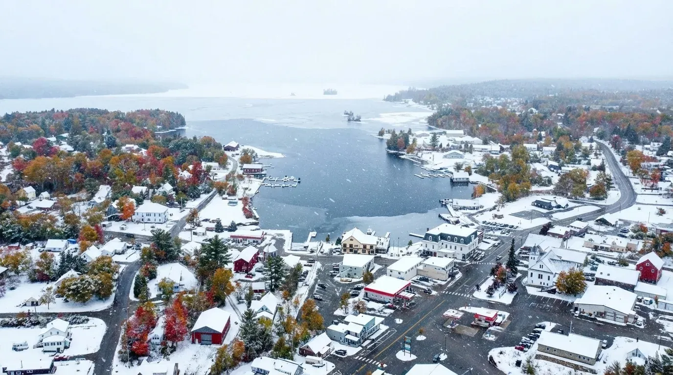
Greenville is the frontier of the Maine wilderness. It sits on the shores of Moosehead Lake, the largest lake in the state at 74,890 acres. It is a town of seaplanes, fishing guides, and logging trucks. If you want to see a moose or disappear into the woods, this is where you start.
Gateway to the North Maine Woods
Greenville is the southwestern gateway to the North Maine Woods and the last town of any size before the logging road network that runs north and west of Moosehead Lake. Nothing inside the woods sells fuel, food or supplies, so this is where a trip gets provisioned.
Only two state transportation roads reach Moosehead Lake at all. Everything else is private timber road, built for hauling wood rather than for visitors, and using it means registering at a checkpoint and paying per person.
The Twenty Mile Checkpoint
The gate most Greenville trips use is Twenty Mile, which North Maine Woods places approximately 20 miles from Rockwood, beyond the bridge crossing the South Branch of the Penobscot River. It is open 6am to 9pm daily. After hours there is self-registration on the checkpoint porch, or access through the Seboomook Electronic Gate.
From here the road network opens into the Ragmuff and Seboomook country and on toward Caucomgomoc. NMWMap lists every North Maine Woods checkpoint with its hours and location, which is worth checking against your planned arrival time rather than assuming.
What it costs
North Maine Woods charges per person, not per vehicle. Day use is $13 for Maine residents and $18 for non-residents. Camping is charged on top at $12 and $15 per person per night. Under 18 is free for both, and 70 and over is free for day use though still liable for camping fees. If you go more than a few times a year, the seasonal day-use passes are $95 for residents and $140 for non-residents, with the summer season running 1 May to 30 September and the fall season 20 August to 30 November.
Arriving after a gate closes costs $20 per vehicle. There is a phone at the checkpoint to register, and you leave payment in an envelope. Staffed checkpoints take cash, checks and cards, but the electronic gates take cash and checks only, so carry cash whatever your plan.
NMWMap’s fee calculator totals this for a whole party across a multi-night trip, which is worth doing before you reach the gate rather than while a queue builds behind you.
Planning the trip
North Maine Woods campsites are first come, first served with no reservations and a two-week maximum, so a plan that depends on one specific site is a plan that can fail. NMWMap maps more than 400 sites across the North Maine Woods, KI Jo-Mary, the Allagash and Baxter, with GPX downloads for Garmin and Gaia.
Two things worth knowing before you commit to dates. Reliable ice on Moosehead runs mid-January to mid-March, not late December, so early-winter trips are a gamble. And the seaplane operators in town run scenic flights over country you would otherwise need a checkpoint permit and a long drive to reach, which is the cheapest way to see the scale of it. Our Moosehead Lake guide has more.
Key Facts
What Greenville Is Known For
Greenville Local Highlights
Things to Do
Living in Greenville
Greenville is remote and rugged. The economy depends heavily on tourism and forestry. It attracts those who love solitude, hunting, fishing, and deep winters.
Weather & Seasons
summer
Cool and breezy, 65-75°F
winter
Severe cold and deep snow, 0-20°F
spring
Late thaw, 40-55°F
fall
Stunning foliage, 45-60°F
Local Wildlife & Nature
How to Get There
Greenville is about 1.5 hours northwest of Bangor via Route 15. It is the 'end of the line' before the paved roads turn to gravel logging tracks.
Satellite preview shows the approximate town outline to help you get oriented before you arrive.
Satellite preview
Greenville outline
Trip Ideas Featuring Greenville
Related Guides
The B-52 Crash Site Memorial
A somber hike on Elephant Mountain to the preserved wreckage of a Cold War bomber.
Best Lakes in Maine 2026: Swimming, Boating & Fishing Guide
Maine's best lakes: Sebago, Moosehead, Rangeley, Belgrade. Swimming, boating, fishing, public access, and camping.
Where to See Moose in Maine: Moosehead, Baxter & More
Compare Maine moose-watching areas, from Moosehead Lake to Baxter and the Golden Road. Find seasonal timing, access information, and safe viewing advice.
Complete Guide to Fishing in Maine
Fishing in Maine: 2026 licence fees, regulations, the best lakes and rivers, and where to find brook trout, landlocked salmon, togue, and striped bass.
Maine Fall Foliage 2026: Peak Dates, Best Drives & Leaf Peeping Guide
Maine fall foliage: peak dates by region, best scenic drives, Rangeley, Acadia, and photography tips.
Frequently Asked Questions
Is the lake really that big?
Yes. State fisheries surveys put Moosehead at 74,890 acres with a maximum depth of 246 feet, and the Bureau of Parks and Lands management plan describes it as nearly 30 miles in length with over 245 miles of shoreline. It feels like an inland sea. Note that the widely repeated '40 miles long' figure is not one any Maine agency publishes.
Do I need a 4x4 vehicle?
In town, no. But if you plan to explore the logging roads north of town (Golden Road, etc.), a vehicle with good clearance and rugged tires is highly recommended.